

Tags: MiddleEast, territoriality, transportation, borders, conflict, governance, political, unit 4 political.
Get Started for FREE
Sign up with Facebook Sign up with X
I don't have a Facebook or a X account


 Your new post is loading...
 Your new post is loading...
Your new post is loading...
Tags: MiddleEast, territoriality, transportation, borders, conflict, governance, political, unit 4 political. 
|


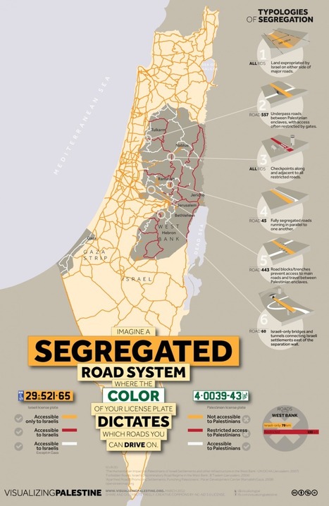
Area/Geography: This is a diagram of what Israel is like for Palestinians and Israelis. It shows extremely restricted access for Palestinians. Whereas Israelis have all of the roads. This diagram fairly falls under the Area/Geography category because of the fact of how the Israeli government is manipulating the area/geography of the land of Israel to suit their best interest.
Here one can see the political territoriality among Israel. For example in this article webpage we saw that people with Palestinian license plates can not drive on Israeli roads. This is one of the many instances where people are segregated according to their beliefs.